For expert advice  call 01832 770883

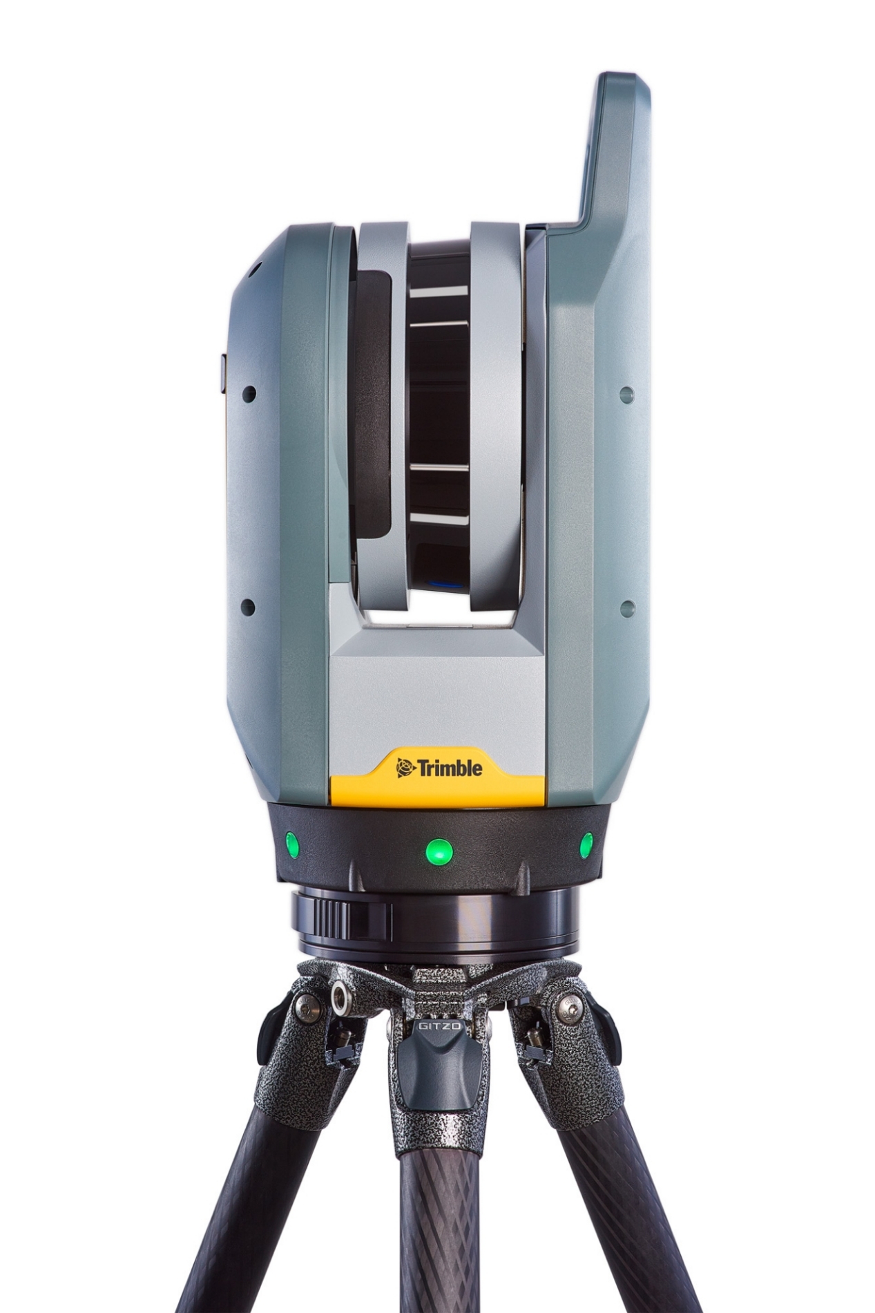 Trimble X7 Laser Scanner Ex. VAT
 Designed for professionals who demand precision and efficiency in their work, this advanced 3D laser scanning system stands out for its high-speed data collection capabilities. With scan durations as quick as 1:35 minutes, users benefit from increased productivity, allowing them to maximize output on job sites without sacrificing quality. The compact and lightweight design of just 5.8 kg ensures that transport and setup are seamless and effortless, making it an essential tool for teams working across various project environments, from construction sites to intricate surveying tasks.
At the heart of this powerful scanner is the intuitive Trimble Perspective software, which streamlines the scanning process and makes complex data management accessible to users of all experience levels. The software integrates user-friendly controls for efficient processing and visualization of scan data, empowering surveyors and geospatial professionals to work effectively in the field. Coupled with innovative features such as automatic calibration through the Trimble X-Drive system, downtime for manual setup is drastically reduced, guaranteeing continuous productivity and dependable results.
The scanner’s cutting-edge functionalities, including integral HDR imaging with 10MP sensors and advanced registration capabilities, further enhance accuracy and detail. Users can expect detailed visual documentation, which is crucial for thorough analysis and compelling presentations. Automatic registration and refinement via Smart Registration Assist not only save time but also boost the confidence of professionals in the data collected, allowing them to leave the job site assured of their results.
Built with durability in mind, the scanner boasts an IP55 rating, providing robust protection against dust and water jets to ensure reliable performance in various weather conditions. This durable construction, combined with survey-grade accuracy of 2 mm, positions it as an ideal solution for discerning clients in surveying, construction, and other related fields. Furthermore, its comprehensive data integration capabilities allow for seamless compatibility with numerous file formats, whether for Trimble or non-Trimbled software, streamlining workflows and elevating project outcomes.
Automatic Calibration: No targets or user interaction required, with on-demand calibration reports for consistent accuracy.
Self-leveling: Ensures automatic survey grade level compensation for precise data collection.
Trimble Registration Assist: Facilitates automatic registration for easy integration of scans.
Georeferencing: Link registered scans to a project coordinate system directly in Trimble Perspective for streamlined data management.
Reliable Workflows: Designed for efficiency in the field, ensuring a smooth data collection process.
Fast Image Capture: Enhances productivity by quickly recording high-quality images.
Laser Pointer: Equipped with a laser pointer for precise georeferencing and single point measurements.
Compact Design: Lightweight and portable, allowing for easy transport to various job sites.
High Accuracy: Delivers precise measurements and detailed 3D data for exceptional survey results.
User-friendly Interface: Intuitive controls and software integration simplify operation for users of all experience levels.
Documentation File Format Size