For expert advice  call 01832 770883

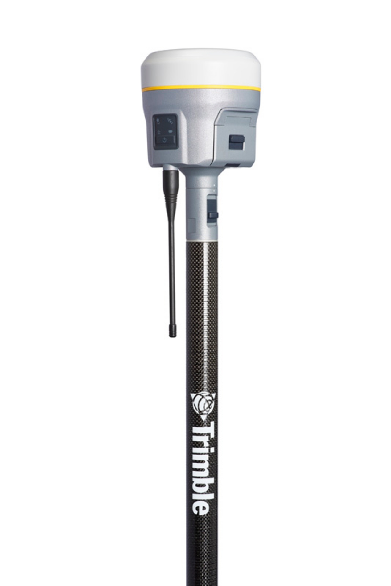 Trimble R12i GNSS System Ex. VAT
 The Trimble R12i GNSS System represents the pinnacle of surveying technology, tailored specifically for professionals who demand superior accuracy, efficiency, and reliability in their work. Whether you are a land surveyor, civil engineer, or construction manager, this advanced GNSS system empowers you to overcome the challenges posed by difficult environments. With Trimble's Inertial Platform (TIP) technology, the R12i offers calibration-free tilt compensation, allowing you to capture precise measurements without the hassle of manual adjustments. Imagine seamlessly targeting obstructed points, even at hazardous locations like road edges or excavation sites, while maintaining full confidence in your data integrity.
Designed to excel in the most demanding GNSS conditions, the Trimble R12i features the revolutionary Trimble ProPoint GNSS positioning engine. This cutting-edge technology provides unparalleled performance in urban canyons, wooded areas, and other challenging terrains, ensuring that you can rely on consistent, accurate positioning regardless of your surroundings. Equipped with an impressive 672-channel capacity and Trimble 360 satellite tracking technology, this system radically enhances satellite signal availability, allowing you to work efficiently without the interruptions commonly associated with signal loss. Coupled with the CenterPoint RTX correction service, you can attain fast, RTK-level precision anywhere in the world, drastically improving your measurement turnaround time.
Not only does the R12i boost operational efficiency, but it is also built to endure the rigors of fieldwork. Its rugged, military-grade design, featuring an IP-67 rating, ensures that it can withstand dust, moisture, and the wear and tear of everyday use. Additionally, the system boasts a long-lasting rechargeable battery, equipped with built-in indicators to keep you informed of power levels, minimizing downtime during critical surveying tasks. With ergonomic considerations and a lightweight form factor, the Trimble R12i ensures comfort even during extended periods of operation, so you can focus on achieving your surveying goals without being weighed down by cumbersome equipment.
In addition to its impressive technical capabilities, the R12i integrates seamlessly with modern technologies, supporting augmented reality applications through Trimble SiteVision. This means you can visualize geospatial data in real-world settings, transforming the way you present and analyze your work. Whether collaborating on-site or managing data remotely, a variety of connectivity options—such as Bluetooth, Wi-Fi, and cellular compatibility—are at your disposal to streamline communication and data management. The Trimble R12i GNSS System is not just an instrument; it is an indispensable partner for professionals aiming to elevate the standard of excellence in surveying and construction projects.
Documentation File Format Size