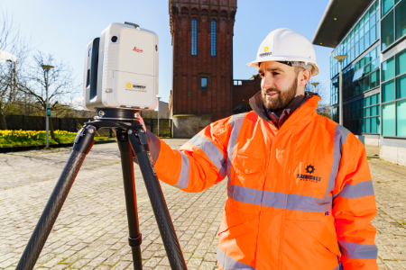
Capture precise 3D spatial data in minutes with 3D laser scanning solutions from Leica Geosystems and FARO. We stock laser scanners, mobile mapping solutions, software and accessories for surveying, construction, BIM and heritage.
We offer the complete laser scanning ecosystem at prices to suit every budget. Choose a terrestrial 3D survey scanner such as the Leica RTC360 or FARO Focus, the compact Leica BLK360 or the handheld BLK2GO for scanning on the move, plus mobile mapping solutions like the Pix4D viDoc RTK rover. We also supply point cloud software, accessories, and reconditioned and ex-hire laser scanners, with expert advice and training to get you scanning with confidence.
3D laser scanning offers numerous benefits, including high-accuracy data capture, efficient workflow, detailed point cloud generation for comprehensive 3D datasets, and diverse applications across various industries such as surveying, film, archaeology, BIM, and more.
We offer a wide range of 3D laser scanners from leading brands, catering to different needs and budgets. Our selection includes handheld scanners, mobile mapping systems, and various accessories to enhance your scanning capabilities. Check our website for the full range.
At Sunbelt Sales, we are committed to providing excellent support. This includes expert advice to help you select the right equipment, access to comprehensive online resources, and additional support services as detailed on our website.
 call 01832 770883