Survey Equipment Training

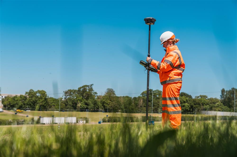
We understand that training and expert technical support are both vital to unlocking the full potential of your survey equipment. We offer structured training programs that enable you to stay up to date with the latest advances, take full advantage of equipment capabilities and help to improve workflow.

Our expert training team are authorised to train across many product types and brands, and are an authorised leica geosystems training partner. In addition to this, Sunbelt Rentals UK are the only authorised training partner for Leica RTC360 workflow training.

We offer courses on Total Stations, Laser Scanners, GNSS Systems, Digital Levels and Cable Avoidance to ensure your employees are trained, developed, and supported. We also offer Machine Control simulator training at our training centres. 

All published courses may be customised, allowing you to get the most from your training investments. Choose between training on-site, at your office or our locations. Alternatively, let us know your training requirements and we will do our best to accommodate.


Total Stations

Getting Started (1 day)

Workflow training for any Leica Total Station, including data exchange with popular CAD packages. Learn the standard functions of your TPS instrument and perform common survey tasks, including detail surveys and setting-out.

Check and Adjust (1/2 day)

From refreshing batteries to running the check and adjust routines, this course takes you through the monthly steps needed to keep your instrument working correctly and accurately.

Worksite+ (1 day)

Getting to grips with three of the most popular additional applications on-board theTS16; Reference Line, DTM Stakeout and Volume calculation.

Traverse (1 day)

A close look at setting up and adjusting a control network. Step-by-step process of using the TS16 and Traverse Kit, including adjustments on-site as well as loading the data into Leica’s Infinity software and generating a final report.


GPS/GNSS

Getting Started (1 day)

Learn the basic concepts of GPS/GNSS positioning. This course looks at workflow training in RTK including detail surveys, coding and export of data, as well as performing site Calibration/Transformation and understanding when to use different types of co-ordinate systems.

Post-Processed Kinematic (1 day)

Focussing on GNSS PPK survey and processing - For when there’s just no phone signal.
For those who can post-process GNSS data and have a SmartNet License there are techniques available for when you don’t have an internet connection. This course focusses on Post-Processed Kinematic surveys and how to get them right.

GNSS Survey and Post Processing (1 day)

A look at the GS16 SmartAntenna and how to take advantage of the developments in GNSS surveying. As well as looking at RTK setups and post-processing GNSS data in Leica’s Infinity software.


3D Laser Scanning

Getting Started Leica (2 days)

Get hands-on with the Leica P Series, learn Cyclone Software for data processing, analysis and preparation, as well as a step-by-step guide to office and field workflows and processes.

Getting Started FARO (2 days)

With FARO’s S and M series comes SCENE software for data processing, analysis and preparation, learn the software and hardware of these Laser Scanners while taking a detailed look at office and field workflows and processes.


3D Hand-Held Laser Scanning

Getting Started (1 day)

Learn the scanning methodologies of using a GeoSLAM hand-held laser scanner. This 1 day course will look at everything you need to survey with confidence from; field practice, workflows, GeoSLAM Desktop software and data visualisation.


Levelling and Infinity

Getting Started (1 day)

An introduction to Leica’s LS10/15 Digital Levels and the processing of data in Leica’s Infinity software. With the replacement of the DNA series, we look at the features of the LS10/15, their workflows and how to generate a report for clients.


GPR (Ground Penetrating Radar)

Getting Started (1 day)

An introduction into the basic theory of how GPR works, their uses and limitations. Following on from the theory side the course then covers how to use the Leica DS2000 and all its available features, coupled with a practical session on using the Leica DS2000.


C.A.T and Genny

User Training Course (1/2 day)

Sunbelt Rentals Survey is able to offer a certified training course on advanced theoretical and practical instruction in the techniques and uses of Radiodetection C.A.T and Genny Series Locators. This half day course can facilitate up to eight people and includes all equipment.

Download our Training Brochure here>>

Contact Us

Fill in the form below for more information about our Survey Training and one of our expert team will contact you as soon as possible.