Picture of Radiodetection LMX100 Picture of Radiodetection LMX100 Picture of Radiodetection LMX100

    Picture of Radiodetection LMX100

    Picture of Radiodetection LMX100 Picture of Radiodetection LMX100 Picture of Radiodetection LMX100
    SPX Radiodetection

    Radiodetection LMX100

    SKU: LMX100

    The Radiodetection LMX100 is a professional ground penetrating radar system designed for utility locating and subsurface investigation. It enables operators to detect both metallic and non-metallic utilities, including plastic pipes, fibre optic cables, and drainage systems that traditional electromagnetic locators may miss. Featuring an intuitive touchscreen interface, integrated GPS, real-time target enhancement, and Wi-Fi reporting capabilities, the LMX100 delivers fast, accurate results in a wide range of ground conditions. Ideal for utility surveys, excavation planning, and damage prevention, the LMX100 helps improve safety, efficiency, and confidence on site.

    Back

    £9995.00 Ex. VAT Inc. VAT

    In stock
    Picture of Radiodetection LMX100 
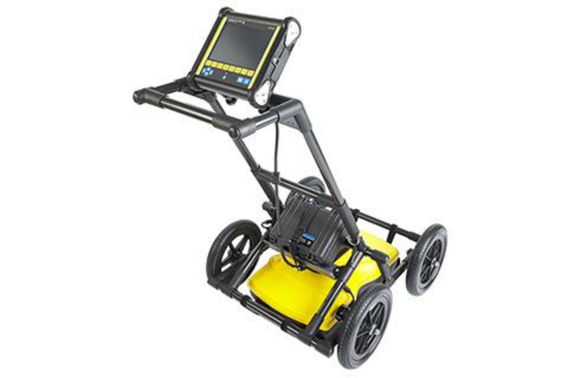
Radiodetection LMX100 £9995.00 Ex. VAT

    Detailed Description

    Radiodetection LMX100 Ground Penetrating Radar (GPR)

    The Radiodetection LMX100 is an advanced Ground Penetrating Radar (GPR) system designed to help utility professionals detect, map, and identify underground infrastructure with confidence. Engineered for utility locating applications, the LMX100 provides a reliable solution for locating both metallic and non-metallic services, including plastic water pipes, fibre optic cables, drainage systems, sewer lines, and other buried assets that may not be detectable using conventional electromagnetic locating equipment.

    Featuring a rugged, field-ready design and an intuitive touchscreen interface, the LMX100 enables operators of all experience levels to quickly collect and interpret subsurface data. The system uses high-frequency radar technology to produce real-time underground profiles, allowing users to visualise buried utilities, identify potential obstructions, and make informed decisions before excavation begins.

    The LMX100 incorporates advanced technologies such as Dynamic Target Enhancement (DynaT) and Dynamic Stacking (DynaQ), which automatically optimise data quality and improve target visibility in varying ground conditions. Integrated GPS functionality allows for accurate positioning and mapping of survey data, while built-in Wi-Fi connectivity enables users to generate and share professional reports directly from the field.

    Designed to improve safety, reduce utility strikes, and increase productivity, the LMX100 is ideal for utility locating, site investigations, excavation planning, construction projects, environmental assessments, and damage prevention programmes. Its ability to locate both conductive and non-conductive underground assets makes it an invaluable addition to any utility detection toolkit.

    Whether used as a standalone utility locating solution or alongside traditional cable and pipe locators, the Radiodetection LMX100 delivers accurate, dependable subsurface information that helps operators work more efficiently, minimise risk, and maintain compliance with safe digging practices.

    Features & Benefits

    • Detects metallic and non-metallic utilities – Locate plastic pipes, fibre optic cables, drainage systems, and buried services that traditional locators may miss.
    • Real-time subsurface imaging – View underground features instantly to support faster decision-making on site.
    • Dynamic Target Enhancement (DynaT) – Improves target visibility for easier interpretation of buried utilities.
    • Dynamic Stacking (DynaQ) – Automatically optimises data quality in varying ground conditions.
    • Integrated GPS – Record and map utility locations accurately for improved survey documentation.
    • Built-in Wi-Fi reporting – Generate and share professional reports directly from the field.
    • User-friendly touchscreen interface – Simple operation reduces training time and increases productivity.
    • Rugged field-ready design – Built to withstand demanding site conditions and daily use.
    • Reduces utility strike risk – Provides greater confidence before excavation begins.
    • Improves site safety and efficiency – Helps teams locate underground assets quickly and accurately.

    Technical Specification

    Document Download

    Documentation File Format Size

    USER MANUAL PDF 6.7 MB

    What's In The Box

    • LMX100 GPR System
    • Integrated GPS
    • Rechargeable Battery
    • Battery Charger
    • Survey Cart & Encoder Wheel
    • User Documentation
    Need some help?