For expert advice  call 01832 770883

 Leica Infinity Survey Software Ex. VAT
 Designed specifically for survey professionals, Leica Infinity Survey Software serves as a vital link between field and office operations, making it the ideal choice for those seeking to manage complex survey data seamlessly. This powerful software suite offers comprehensive solutions for reporting, archiving, and navigating data throughout the entire project lifecycle. Users can leverage its capabilities to facilitate smooth transitions of raw data into actionable insights, ultimately leading to better decision-making and heightened project efficiency.
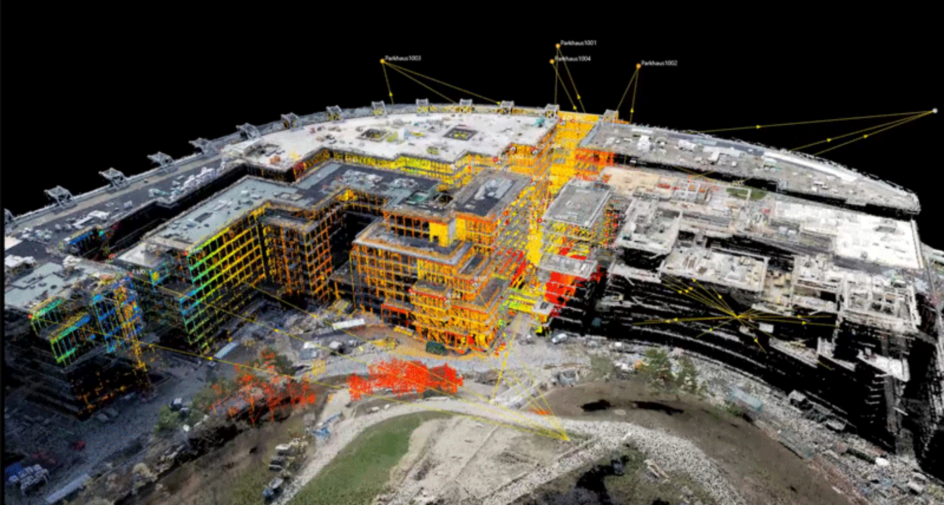
One of the standout features of this software is its robust 3D data processing capability, which enables users to visualize and manipulate 3D datasets quickly. Whether you are working with total station data, GNSS measurements, levels, or scanning data, Leica Infinity ensures you have the tools necessary to generate accurate reports and visualizations. Such capabilities empower teams to gain vital project insights swiftly, allowing for faster turnaround and enhanced results.
At the heart of Leica Infinity is its commitment to streamline workflows between field crews and office staff. This interconnected approach enhances collaboration and reduces the risk of errors during data transfer. With instant access to both raw and processed data, teams can conduct real-time cross-checks, enabling immediate adjustments and boosts in accuracy. This level of transparency ensures that all stakeholders are aligned and informed, leading to a cohesive working environment.
Moreover, Leica Infinity is designed for flexibility and scalability. Its modular structure allows users to start with the features they need and expand as project demands evolve, making it a cost-effective solution for any surveying operation. With integrated services for data exchange, advanced point cloud management, and compatibility with various data formats, this software ensures that your essential data is never out of reach. As such, Leica Infinity is not just a software solution; it is a comprehensive tool that enhances both efficiency and accuracy across all aspects of geospatial projects.