For expert advice  call 01832 770883

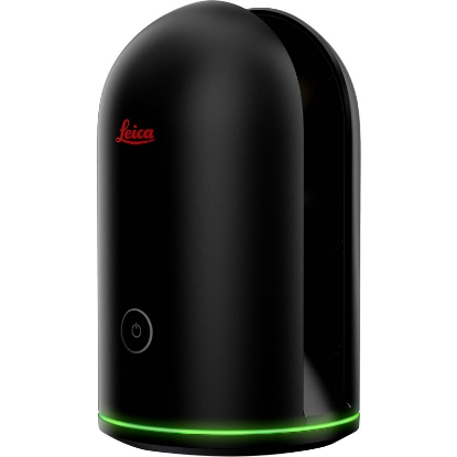
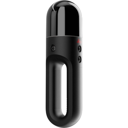
 Leica BLK2FLY Autonomous Flying Laser Scanner Ex. VAT
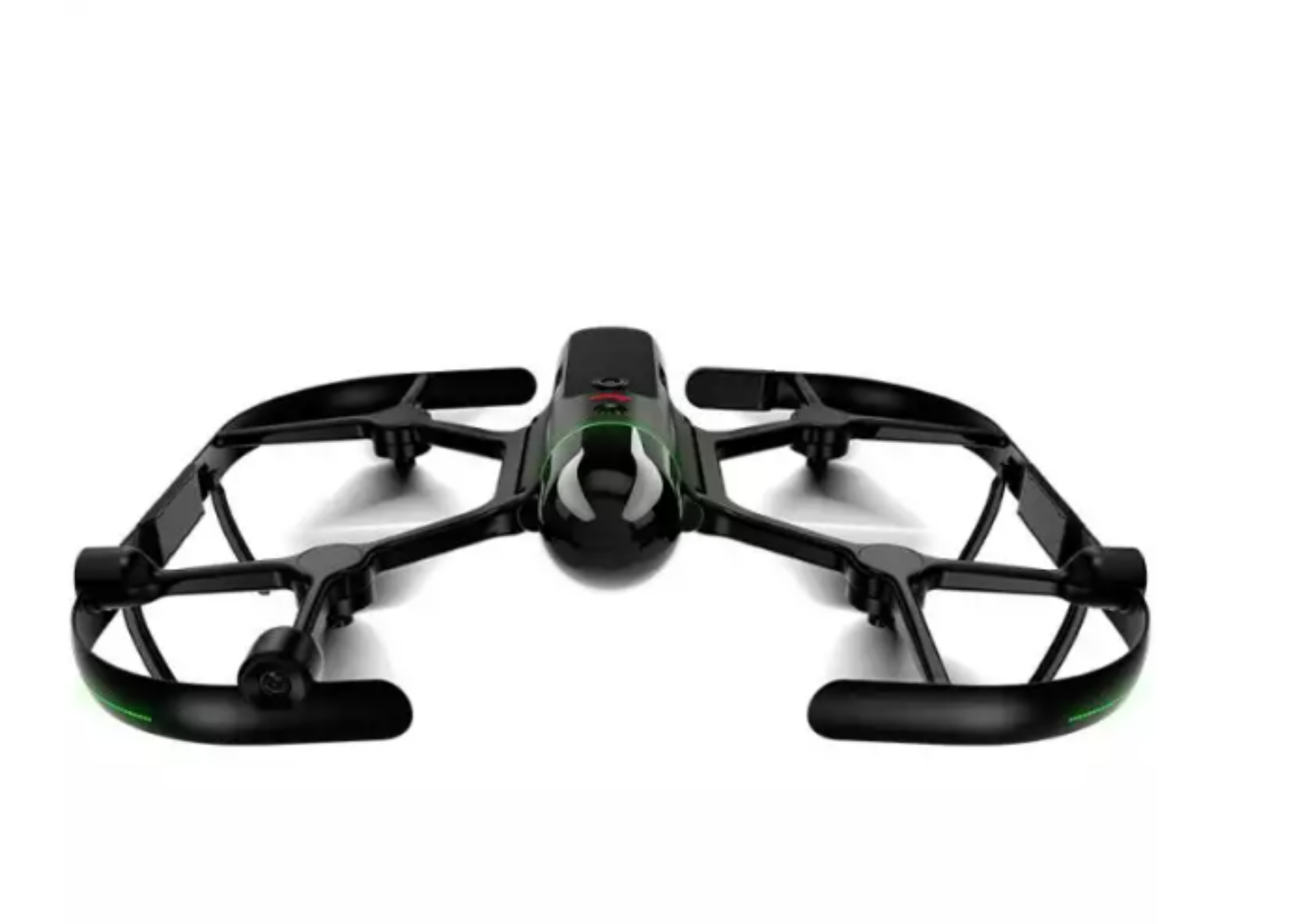
 Experience the future of surveying and mapping with the innovative Leica BLK2FLY Autonomous Flying Laser Scanner. This advanced piece of technology is designed specifically for construction professionals, architects, and land development specialists who require precision and efficiency from their tools. The device employs cutting-edge LiDAR scanning technology that captures an impressive 420,000 points per second, generating meticulous 3D representations of complex environments. Whether you're assessing building facades, rooftops, or vast land areas, the BLK2FLY allows for seamless operation, significantly reducing labor costs and time on-site.
One of the standout features of the BLK2FLY is its autonomous flight capability. With just a few taps on your tablet, you can set the device to autonomously plan and execute its flights without manual intervention, which minimizes user errors and streamlines the workflow. The BLK2FLY can scan large areas—up to 4,700 m² in merely 12 minutes—making it an efficient choice for professionals looking to enhance productivity. When paired with advanced obstacle avoidance technology, the device ensures safe navigation around crowded and complex job sites, allowing you to trust its operations even in delicate scenarios.
Designed for mobility, the BLK2FLY weighs in at only 2.6 kg and offers a foldable structure for easy transport, ensuring that you have the cutting-edge technology at your fingertips, wherever the project may lead. Its durable IP54-rated construction means you can rely on it in various weather conditions, making it suitable for outdoor use and protecting it from dust and moisture. Coupled with long battery life, providing up to 13 minutes of uninterrupted flight time, you can take on extensive scanning tasks without concern for equipment reliability.
Moreover, the integration capabilities of the BLK2FLY stand out with full wireless connectivity options, including LTE, WLAN, and Bluetooth, facilitating real-time data transfer and visualization via the intuitive BLK2FLY Live app. This ensures that your data flows smoothly into Leica Cyclone software or the HxDR cloud solution, allowing for easy processing and management of scanned data. Capture the intricate details of your environment, share them with stakeholders, and transition effortlessly from data capture to actionable insights with the BLK2FLY—a comprehensive tool designed to elevate your surveying and mapping capabilities.
Documentation File Format Size