For expert advice  call 01832 770883

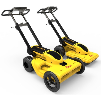
 IDS GeoRadar Stream C Ground Penetrating Radar Ex. VAT
 Accurate 3D utility mapping
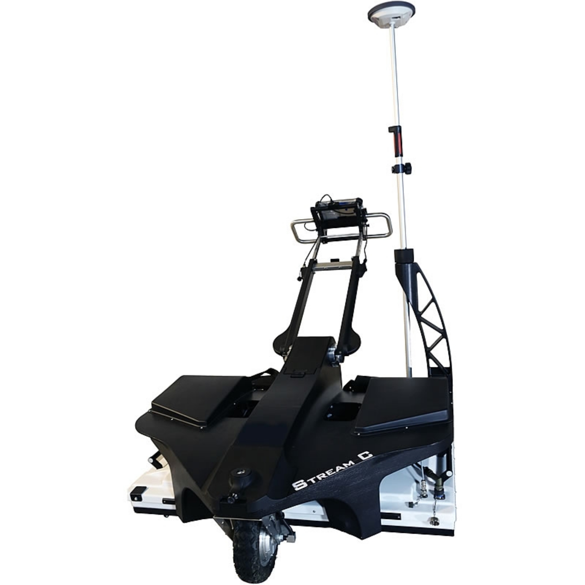
Stream C is the compact array solution for real-time 3D mapping of underground utilities and features. Increased levels of accuracy are provided by a large antenna array to automatically detect pipes and cables.
Stream C is aided by ergonomic features including electronic ride height adjustment, options to tow manually or with a small vehicle and motor assisted drive wheel.
Real time software for advanced viewing
Stream C is supplied with the OneVision and GRED HD 3D CAD software suites.
OneVision
Acquisition software for use in the field. Providing real-time target viewing, onsite object mapping and GPS navigation, OneVision is a software application for advanced GPR data collection. This powerful tool can be used with an array of antennas when performing utility mapping, archaeological and environmental surveys, and extensive mapping of medium to large size projects.
OneVision is a powerful application for advanced surveys with integrated navigation, featuring:
OneVision provides increased productivity and reduced costs. Other benefits include:
Features:
Massive array of 34 antennas in two polarisations: An accurate 3D reconstruction of the underground utility network is created in a single scan.
Automated Pipe Detection (APD): Real-time automatic detection of buried pipes and cables.
Compact size: Stream C’s small dimensions enable it to survey areas inaccessible to large systems while maintaining the same accuracy.
Robust construction: Built to the highest standards and with robust materials so that it can be used on harsh, demanding environments.
3D radar tomography: Real-time tomography on a GPS or total station assisted cartographic background.
Professional surface survey: Quickly produce subsurface GIS based digital maps when pipes, cables and buried objects are automatically transferred to CAD and GIS formats.
Benefits of the Stream C include:
High productivity: Surveys only need to be performed in one direction to ensure optimal detection of both longitudinal and transversal pipes
No advanced training needed: The system automatically detects and locates the position of pipes in real-time and displays them on the screen
Reduced user fatigue: Thanks to electronic ride height adjustment and a motor assisted drive wheel
Facilitates large surveys: The system can be towed manually or with a small vehicle, increasing the acquisition speed (up to 6 km/h)
Documentation File Format Size